
Eco
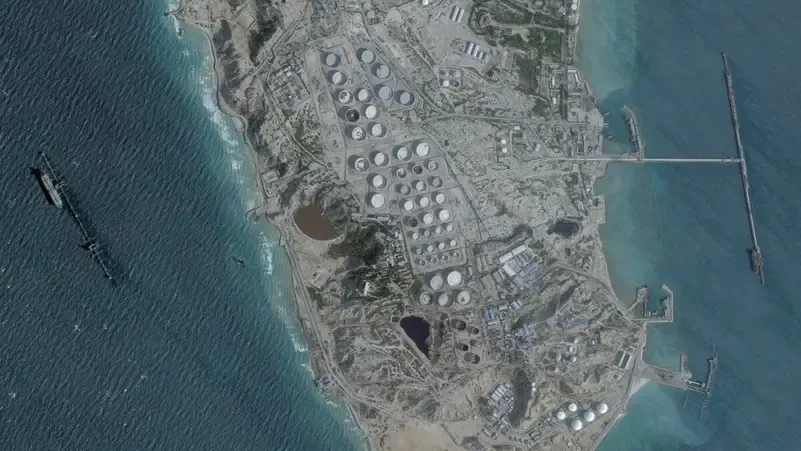
Satellite images detected about 23 oil tankers near the main oil export center in Iran, which is the largest gathering of ships around Kharg Island since the start of the blockade, Bloomberg reported today, Monday.
In detail, these tankers — anchored in waiting areas around Kharg Island, or positioned at crude oil or liquefied petroleum gas loading berths — appeared in satellite images taken on May 16, viewed by Bloomberg News and confirmed by an analysis from United Against Nuclear Iran, an American non-profit advisory group focusing on Tehran's policies.
While this number compares to only four tankers on April 13, just before the gathering of US warships in the Gulf of Oman to monitor and intercept vessels began.
For his part, Charlie Brown, an advisor to the organization, said: "Ships are gathering in waiting areas around the island, indicating increasing delays and bottlenecks in Iran's crude oil export system."
The May 16 count also includes a ship that appears anchored in the southeastern corner of Kharg Island, at a terminal primarily used for exporting liquefied petroleum gas (LPG), usually used as cooking fuel. While satellite images show that crude oil loading berths remained empty.
However, this ship is the second of its kind to be observed there since the start of the war. The ship "Nedy" had been spotted at the facility in early April, before later appearing in the waters off the western coast of India in early May, according to ship tracking data and satellite images.
Activity at Kharg Island slowed down as exports were disrupted, leading to the filling of storage facilities, according to Bloomberg. With loaded tankers unable to leave the area, and no new, empty ones entering to load crude oil, Iran is forced to slow down its oil production.